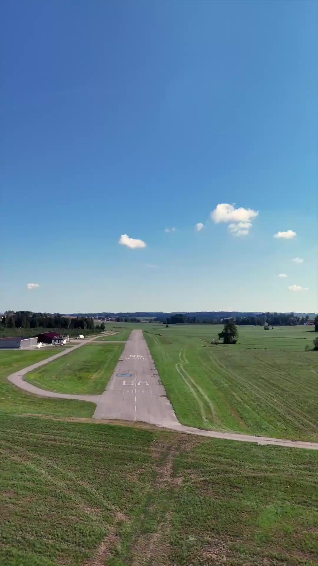
Vogtareuth Airfield
At home in the Bavarian Alpine foothills between Rosenheim and Wasserburg since 1967, the Alps on the southern horizon. A family-friendly airfield in the Chiemgau where you're always welcome — easy-going and personal.
Approach & Weather
Live data from the Holfuy station on site. Updated every 60 seconds.
Data not verified — does not replace an official weather briefing. Details & statistics →
Tall trees in the approach sector, well before the threshold — because of their height, do not fly the approach too flat. LDA 517 m.
The stream (Achel) runs very close to the asphalt runway. Do not touch down before the threshold. In north-westerly and northerly conditions, expect turbulence from the adjacent forest.
The AIP and online briefing are binding — these notes do not replace flight preparation.
At the Airfield
Hangar space, three active clubs and events.
Hangar space
Gliders, UL & trailers available · powered aircraft waiting list · discount for new tenants
MFC Rosenheim e.V.
Powered flight · PPL(A) and LAPL(A) training (ATO) on a Cessna 172 R
FSG Bölkow e.V.
Gliding, alpine & cross-country, powered flight, trial flights
Hagelabwehr Rosenheim e.V.
Active hail defence · 2× Partenavia P68 C-TC · 4,800 km² coverage
Events
No events are currently scheduled
History
On 30 September 1967 the first aircraft landed in the Heubühlmoos — and flying in Vogtareuth has continued uninterrupted ever since.
Three flying enthusiasts get the airfield off the ground. After an approval process spanning eight authorities — in which the Vogtareuth site prevails over five other locations — the first aircraft lands in the Heubühlmoos on 30 September 1967. Back then the field is little more than a wet meadow.
Paving and expansion: the runway is tarred and two hangars are built. MFC Rosenheim and FSG Bölkow move in, and the district's hail defence is stationed in Vogtareuth — to this day two Partenavia P68 protect a 4,800 km² area along the Alpine edge from here.
The airfield sees its liveliest era — with up to 10,000 movements per year.
50 years of Vogtareuth Airfield — celebrated with a ceremony on site and busy flight operations. Around 60 active pilots now fly from EDNV.
Auer Flugplatz GmbH takes over operations and modernises the airfield: a new digital presence with live airfield status and online briefing, plus cashless landing fees via PayPal.
Contact & Directions
We look forward to hearing from you
Auer Flugplatz GmbH Am Flugplatz 1 83569 Vogtareuth, Germany
Complete the online briefing once — valid until revoked. Please check the current airfield status before every flight.
Show larger map · © OpenStreetMap